NASA WorldWind Project Suspension FAQ
An update have been posted.
An update have been posted.
WorldWind team would like to inform you that starting April 5, 2019, NASA WorldWind project will be suspended. All the WorldWind servers providing elevation and imagery will be unavailable. While you can still download the SDKs from GitHub, there will be no technical support. If you have questions and/or concerns, please feel free to email at:
That is a quote from https://worldwind.arc.nasa.gov/news/2019-03-08-suspension-notice/
This affects Mapton and it’s users since WorldWind is one of the map engines used in Mapton.
Enjoy the new snapshot.
Some of the changes since the last snapshot
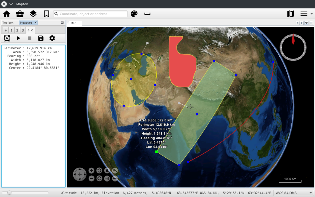
The WorldWind MapEngine just got a measuring tool that measures the following geometries:
The geometries can easily be exported as a KML file for use with Google Earth et al.