It’s Open!

Mapton is now capable of opening files, sort of.

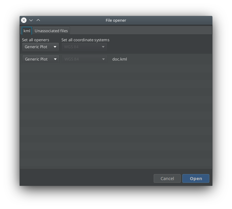
You can drop files directly on the map or go through the meny item Open, which brings up a regular file dialog.

After that, the File opener dialog will be displayed. Here one can select what do do with the files and set their coordinate systems.

It’s up to the plugins to provide the actual functionality on how to read the files in question and what to do with it. Such plugin item is called a CoordinateFileOpener.

So far there is the Files plugin that supports kml/kmz files to some extent and a CoordinateFileOpener for geotagged images is planned.

The File opener dialog

Manage data updates

Manage your data updates with the recently added Update manager.

The Update manager assists in updating data provided by the plugins, not the plugin themselves.

First one out is the GeoNames search engine database, which is no longer bundled with Mapton, instead, you will be prompted to install it if it’s missing and update if it’s old. As a result of that, the mapton.zip got reduced from 61 to 55 MB. 🙂

This is part of the Mapton API available to plugin developers.

HiDPI – a huge improvement

As of today, Mapton now supports UI scaling.

It’s available in the development branch and in the new snapshot.

Start mapton with an argument like this:

mapton --fontsize 24

or edit your $MAPTON_INSTALL_DIR/etc/mapton.conf like this:

default_options="--branding mapton -J-Xss2m -J-Dnetbeans.logger.console=true -J-ea --fontsize 24"

fontsize 12 equals scale 1.0, so 24 will double it.


Chart support

A ‘Chart window’ was just introduced in Mapton, the intended use is to display charts when clicking on a map object or similar. The chart can easily be fed with data or to be replaced with a very customized chart object.

Mapton Measure Up

The WorldWind MapEngine just got a measuring tool that measures the following geometries:

  • Line
  • Path
  • Polygon
  • Circle
  • Ellipse
  • Square
  • Rectangle

The geometries can easily be exported as a KML file for use with Google Earth et al.